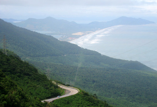
The Hai Van Pass crosses over a spur of the Truong Son mountain range that juts out into the sea and serves as a geological and geographical dividing line. It forms a physical boundary between the north and the south of Viet Nam, and in the past has been considered an important strategic frontier post along the north-south road. From the top of the Hai Van Pass, one can admire Lang Co to the north and Da Nang to the south.

The Hai Van Pass
During the Nguyen Dynasty, at the beginning of the nineteenth century, King Minh Mang ordered a fortified gateway to be built at the summit to protect Hue Citadel. The side of the gate facing north to Thua Thien-Hue Province is inscribed with the three words “Hai Van Quan”. The other side, looking down to Da Nang and Quang Nam Province, has “Thien ha de nhat hung quan”, meaning “the grandest gateway in the world”.
At the beginning of the twentieth century, a 21km-long railway (about 100m above sea level) was constructed around the Hai Van Pass. The curving railway includes 7 tunnel sections, the longest of which is the 562m-long Sen Tunnel.

The Hai Van Tunnel
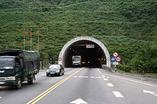
On 27 August 2000, construction began on a 6,274m-long road tunnel under Hai Van Pass. The tunnel breakthrough was celebrated on 28 October 2003 and it took another 5 years to be completed and opened to traffic. It is now the longest and most modern tunnel in South East Asia. Most vehicles now take this tunnel route, and the diversion of traffic from the Pass road has made that a much safer, quieter and more enjoyable route. Motorbikes and bicycles are not permitted to be ridden through the tunnel, but are carried through on shuttle vehicles.

